This division is recognized as Center of Excellence in Spatial Environmental Planning with focus on Industrial Planning by Ministry of Environment & Forests, Government of India.
Expertise From conceptualization to deployment of the projects.
Infrastructure
Full fledged GIS/Remote Sensing infrastructure to deliver full cycle GIS/RS solutions.
Application Domains
Industry Sector
Eco Industrial Estates
Environmental Management Plans for existing Industrial Estates
Environmental Impact Assessments (EIA)
Environmental Planning
State of Environment Reports
Environmental Atlas
Water Resources
Ecological Studies in Catchment areas of major bodies / Drinking water sources
Catchment Area Treatment Plans for new Irrigation Projects
Area assessment studies for carrying out Health Impacts due to agriculture in urban and peri-urban area using sewage.
Drainage map of Pulichintala Catchment Area Satellite Image of Pulichintala Catchment Area
Disaster Management
Assesment of impacts on highways during trasportation of hazardous and toxic material.
Assesment of impact due to dissoster in industrial areas and maping dissaster management services.
Coastal Zone Management
Integrated Coastal Zone Environmental Management Plans.
Hazardous and Solid Waste Management
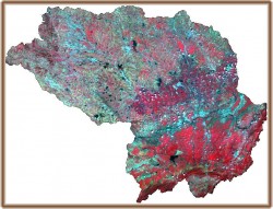
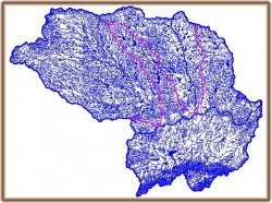
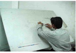
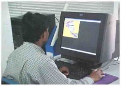
Identification of Treatment Storage Disposal Fecility (TSDF) sites.
Identification of Munciple Solid Waste (MSW) sites.
GIS
What GIS Can Offer
Industrial estate planning studies.
Zoning atlas for siting of industries.
Identification of possible candidate Zones for TSDF sites.
GIS mapping of vulnerable areas.
GIS mapping of Traffic Corridor with risk potential studies during transportation of hazardous and toxic chemicals.
Resources at GIS
Hardware – Graphic workstations and digitization tables.
Software – Advanced GIS and Remote sensing softwares.